


WALNUT TWP Voting District, Palo Alto County, Iowa
About
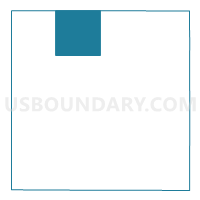
Outline

Summary
| Unique Area Identifier | 583017 |
| Name | WALNUT TWP Voting District |
| County | Palo Alto County |
| State | Iowa |
| Area (square miles) | 35.47 |
| Land Area (square miles) | 35.47 |
| Water Area (square miles) | 0.00 |
| % of Land Area | 100.00 |
| % of Water Area | 0.00 |
| Latitude of the Internal Point | 43.21220900 |
| Longtitude of the Internal Point | -94.73783590 |
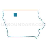
Maps

Graphs
Select a template below for downloading or customizing gragh for WALNUT TWP Voting District, Palo Alto County, Iowa


Neighbors
Neighoring Voting District (by Name) Neighboring Voting District on the Map
- EMMETSBURG TWP W/O EMMETSBURG Voting District, Palo Alto County, IA
- FREEDOM TWP W/O EMMETSBURG Voting District, Palo Alto County, IA
- HIGH LAKE TWP W/O WALLINGFORD Voting District, Emmet County, IA
- HIGHLAND TWP Voting District, Palo Alto County, IA
- JACK CREEK TWP Voting District, Emmet County, IA
- LOST ISLAND TWP Voting District, Palo Alto County, IA
- TWELVE MILE LAKE TWP W/O WALLINGFORD Voting District, Emmet County, IA
- VERNON TWP Voting District, Palo Alto County, IA
Top 10 Neighboring County Subdivision (by Population) Neighboring County Subdivision on the Map
- Emmetsburg township, Palo Alto County, IA (2,834)
- Freedom township, Palo Alto County, IA (1,446)
- Walnut township, Palo Alto County, IA (1,071)
- Highland township, Palo Alto County, IA (998)
- High Lake township, Emmet County, IA (493)
- Lost Island township, Palo Alto County, IA (227)
- Twelve Mile Lake township, Emmet County, IA (156)
- Vernon township, Palo Alto County, IA (97)
- Jack Creek township, Emmet County, IA (89)
Top 10 Neighboring Place (by Population) Neighboring Place on the Map
Top 10 Neighboring Unified School District (by Population) Neighboring Unified School District on the Map
- Emmetsburg Community School District, IA (4,991)
- Ruthven-Ayrshire Community School District, IA (1,548)
- Graettinger Community School District, IA (1,367)
Top 10 Neighboring State Legislative District Lower Chamber (by Population) Neighboring State Legislative District Lower Chamber on the Map
Top 10 Neighboring State Legislative District Upper Chamber (by Population) Neighboring State Legislative District Upper Chamber on the Map
Top 10 Neighboring 111th Congressional District (by Population) Neighboring 111th Congressional District on the Map
Top 10 Neighboring Census Tract (by Population) Neighboring Census Tract on the Map
- Census Tract 9603, Palo Alto County, IA (3,998)
- Census Tract 9601, Palo Alto County, IA (1,970)
- Census Tract 701, Emmet County, IA (1,929)
- Census Tract 702, Emmet County, IA (1,833)
- Census Tract 9602, Palo Alto County, IA (1,813)
- Census Tract 9604, Palo Alto County, IA (1,640)